Fun rides at ChimeLong Amusement Park, GuangZhou 广州

PanYu, GuangZhou.


[640],shadow=true,start=,stop=
[320],shadow=true,start=,stop=

Related Videos

Featured Videos

ShenZhen night walk
With Walk East ...
SuZhou city : night-time fly over and time-lapse
In particular, the SuZhou Industrial Park by JinJi Lake (first video).
Business talk – Amazon and Alibaba, Apple and XiaoMi
With Pascal Coppens and Steven Van Belleghem ...
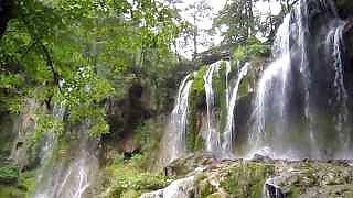
Scenes from JiuZhaiGou 九寨沟
JiuZhaiGou Valley (九寨沟), literally 'Nine Villages Valley', is a nature reserve and national park located in the north of SiChuan province, near the GanSu border. JiuZhaiGou is part of the MinShan mountains on the edge of the Tibetan Plateau, and is known for its many multi-level waterfalls, colorful mineral lakes and snow-capped peaks. The elevation ranges from 2,000 to 4,500 meters (6,600 to 14,800 feet). It lies 330 km (205 miles) north of the provincial capital of Chengdu and is a UNESCO World Heritage Site. This remote region has been inhabited by various Tibetan and Qiang peoples for many centuries. The valleys here are lined with 55 km of roads for shuttle buses, as well as wooden boardwalks and small pavilions. The boardwalks are typically located on the opposite side of the lakes from the roads. Many visitors will first take the shuttle bus to the end of RiZe or ShuZheng valley, then make their way back downhill by foot on the boardwalks, taking the bus when the next site is deemed too distant. JiuZhaiGou is a ten hour bus ride from ChengDu, or one can fly from ChengDu or ChongQing to JiuZhai HuangLong Airport, then take an hour long bus ride to HuangLong, or a 90 minute ride to JiuZhaiGou. There is also a daily flight to Xi'An, in the peak season, and from BeiJing, ShangHai and HangZhou.
ChangBai Mountain 长白山
ChangBai Mountain, ChangBaiShan ('Ever White Mountain'), is located in the south east of JiLin province, on the border between China and North Korea. The mountain is actually a volcano, with a height of 2,744 meters (9,000 feet), the highest mountain in north east China. ChangBai Mountain TianChi is the deepest lake in China, which was formed after a massive eruption in the year 946 and is about 5 kilometers (3.1 miles) wide; technically, this is called a caldera. The origin of the name comes from the altitude - 'The Lake of Heaven'. TianChi is surrounded by 16 mountains, which makes the lake just like a gorgeous emerald among them. The average temperature here is about −24 °C (−11 °F) in January, and 10 °C (50 °F) in July, remaining below freezing for eight months of the year. Great films by Sticker Travel ...
A stay in tropical SanYa 三亚, HaiNan 海南 island
Filmed in 2007
Walnuts 核桃 – harvesting and preparing
An open-air, walnut oil based family feast in YunNan province ...
The beautiful Tibetan Plateau 西藏, west China
The extraordinarily beautiful ShiLin 石林 Stone Forest Geological Park
石林, ShiLin County, YunNan, south China. This area, covering around 500 square kilometers in all, lies about 90 km east of the provincial capital KunMing and is comprised of seven scenic areas featuring amazing limestone karst rock formations. The Stone Forest began around 270 million years ago as a shallow sea. Extensive deposits of sandstone overlaid by limestone accumulated during the Permian period. Subsequent uplift of this region followed by exposure to wind and rain shaped the landscape we see today. Filmed in Ultra HD (4K).
More on XinJiang – lies and reality (and why)
With Daniel Dumbrill ...
WuHan city night walk, HuBei province
With Walk East ...
Beautiful moments in GuiLin 桂林
GuangXi province, south China ...

A selection of popular videos

Keyword / tag search :